
For landscape photographers eager to expand their horizons, drone photography offers unparalleled perspectives and creative freedom. In this guide, we’ll cover site selection, safety protocols, image‑quality techniques, and the best drones on the market, ensuring you capture breathtaking aerial landscapes with confidence and professionalism.
Landscape photography is one of the most rewarding creative outlets. The ability to document Earth’s natural beauty from new angles not only enriches your portfolio but also deepens your appreciation for the planet’s diversity.
With the rapid evolution of recreational and commercial drones over the past decade, aerial landscape photography has reached unprecedented heights—literally—allowing photographers to frame scenes from viewpoints previously unattainable.
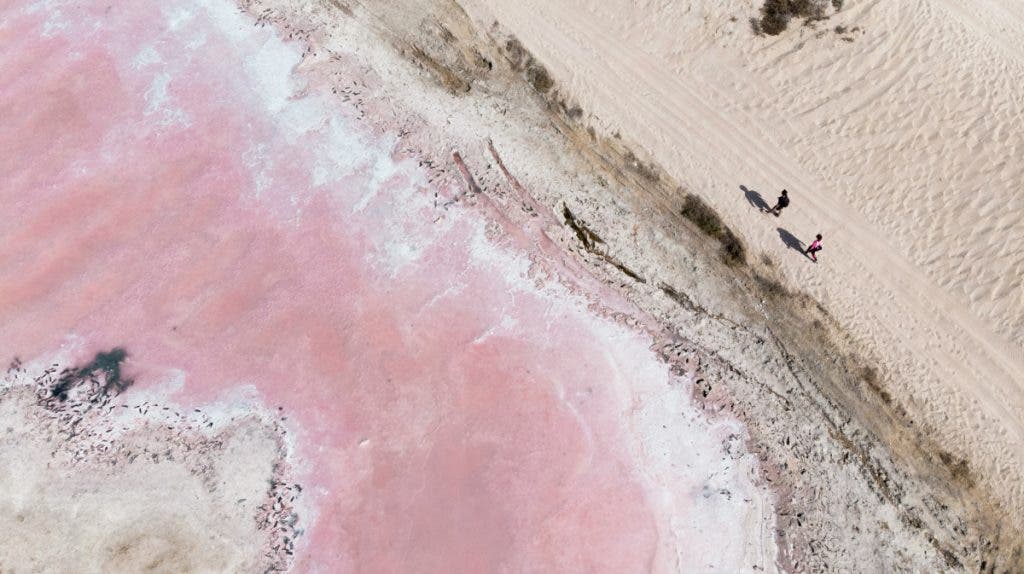
Photo by Augustine Wong
How to Choose a Location for Drone Landscape Photography
Is the location legal to fly at?
Verifying that a site is a legal fly zone is essential, yet many novice pilots overlook this step. Areas such as airports, national parks, or wildfire zones often carry permanent or temporary flight restrictions. Before you even plan a flight, review local aviation regulations, obtain necessary permits, and confirm the zone’s status—regardless of whether you’re flying commercially or for recreation.
Are the weather conditions reliable and favorable?
Modern drones handle wind and light better than ever, but they still have limits. Always check the forecast for your target location and choose a window with stable weather. Remember that no consumer drone is waterproof; avoid flying in rain or high humidity. For wind, use the manufacturer’s maximum wind‑resistance rating as a guide—limit operations to roughly two‑thirds of that value. For example, if a drone’s top speed is 40 mph, keep wind speeds below 26 mph to maintain control.
Can you fly safely at this location?
Safety is paramount, especially in challenging terrains like canyons or valleys. Follow these two core guidelines: 1) Maintain a strong GPS and radio link to prevent loss of control; 2) Keep a clear line of sight at all times to avoid collisions and enable rapid recovery if something goes awry.
How to Keep Your Drone Safe in Remote Locations
Ensure robust satellite and GPS signal before takeoff
Reliable GPS and cellular data are vital for situational awareness. They allow you to monitor the drone’s exact position and automatically return to the home point if communication is lost. In unfamiliar, remote areas, a weak signal can mean the difference between a smooth flight and a crash.
Keep the home point updated
Always set your drone’s home point to the exact location of your take‑off. This prevents unintended landings on unsuitable terrain and gives you a reference for return‑to‑home procedures during emergencies.
Keep firmware up to date and perform pre‑flight calibration
Outdated firmware can introduce bugs or limit flight performance. A full calibration—including the gimbal, motors, and sensors—ensures balanced operation and reduces the risk of propeller or motor failure.
Activate collision sensors
Most drones feature front, rear, and side collision sensors by default. Keep them enabled when flying in unfamiliar landscapes; they detect trees, cliffs, and other obstacles, helping prevent hard impacts.
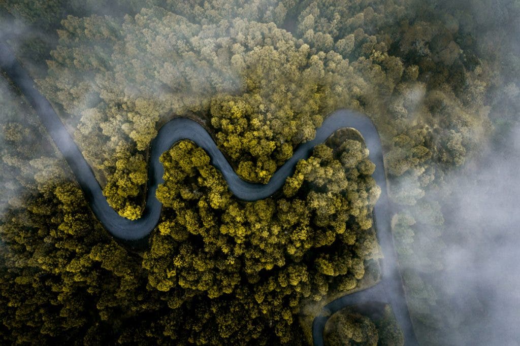
Photo by Alexis Antoine
How to Get the Best Image Quality in Drone Landscape Photography
Shoot in RAW
RAW files preserve the raw sensor data, granting you maximum flexibility in post‑processing. Unlike compressed JPEGs, RAW images retain detail and dynamic range, which is essential for capturing the full spectrum of natural scenes.
Shoot at a low ISO
Set your ISO to 100–200 for most daylight conditions. In low‑light or high‑contrast scenes, 400 ISO remains safe and keeps noise at bay. The lower the ISO, the sharper and cleaner your images will be.
Utilize image stacking for superior results
Stacking—whether exposure, focus, or panorama—combines multiple images into a single master file, enhancing depth, sharpness, and dynamic range. These techniques can elevate a consumer‑grade drone photo to near‑professional quality.
Choose the right drone
When selecting a drone, prioritize sensor size and resolution. A 1‑inch sensor delivers exceptional low‑light performance and dynamic range; at a minimum, a ½‑inch sensor is advisable. Pair this with a high‑resolution sensor (20 MP+), and you’ll have the foundation for stunning aerial imagery.
Best Drones for Aerial Landscape Photography
Below are three top‑tier drones that combine large sensors, high resolution, and advanced flight features, making them ideal for landscape work.
DJI Mavic Pro 3
Overview: Widely regarded as the premier prosumer drone, the Mavic Pro 3 offers a 3‑axis gimbal and a tri‑camera system that blends wide‑angle and telephoto lenses for unmatched versatility.
Key Features:
- 3‑Axis Gimbal with Tri‑Camera System:
- 20 MP 5.1K wide‑angle 4/3 CMOS Hasselblad
- 70 mm 48 MP 3× zoom medium telephoto lens
- 166 mm 12 MP 7× zoom telephoto
- 7 intelligent flight modes
- 43‑minute flight time
- O3+ transmission, 9.3‑mile range
- Omnidirectional avoidance with APAS 5.0
- D‑LOG, D‑LOG M & HLG post‑processing support
DJI Mavic Air 3
Portable yet powerful, the Mavic Air 3 brings many professional features to a travel‑friendly design. Its dual wide‑angle and 3× telephoto cameras capture diverse landscapes.
Key Features:
- Dual wide‑angle & 3× telephoto cameras
- 4K 100, 4K 60 HDR, or 2.7K vertical video; up to 48 MP stills
- 1/1.3″ CMOS sensor
- 10‑bit D‑Log M & 10‑bit HLG color modes
- Up to 46‑minute flight time
- Omnidirectional APAS 5.0 avoidance
- 12.4‑mile range with OcuSync 4
- Waypoint planning for advanced routes
DJI Mini Pro 4
Compact yet capable, the Mini Pro 4 offers excellent image quality while staying under 249 g—a weight limit that simplifies legal compliance in many regions.
Key Features:
- 4K 100 video & 48 MP RAW stills
- Omnidirectional obstacle avoidance
- Under 249 g weight class
- 45‑minute flight time
- Vertical shooting for social media
- FocusTrack subject‑tracking system
- Automatic shooting modes
- Foldable, travel‑ready design
Conclusion
Aerial landscape photography is reshaping how we document and experience the world. As drone technology continues to evolve, so will the possibilities for creative expression. If you’re ready to take the next step, these insights and drone recommendations will help you capture stunning, high‑quality aerial images that stand out.
For gear that matches your ambition—whether it’s a new drone or complementary accessories—Adorama offers a comprehensive selection to support your journey.

Nathan Lee Allen
Nathan Lee Allen is a storyteller and photographer based in Kentucky. Explore his portfolio at nathanleeallen.com, follow him on Facebook at Peaktopier Global Studio, or connect on Instagram @nathanleeallen.