Mapping, flight logs, weather, analytics — these types of applications can take your flight capability to the next level. Not to mention, to the next level in your business.
From the first smartphone apps to what is available today, drone software has made quantum leaps in power and features. Let’s break down ten of the best pieces of software on the market to enhance your flights:
-
Kittyhawk – Comprehensive Flight Management
Kittyhawk is one of the most comprehensive drone management applications available. It offers:
- Flight logs
- Weather conditions
- Drone tracking
- Pre-flight planning
- In-flight operations
- Team management
- Realtime camera streaming
- Cross-device integration
- Cloud storage
- And more
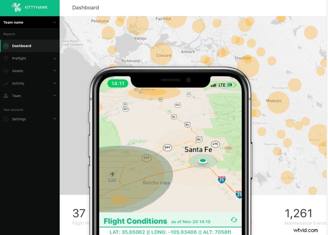
This type of platform is a godsend for commercial pilots. It provides some of the most important logging, tracking, planning, and management features a professional pilot needs — all in one place.
Their pricing is quite affordable as well, and they offer solo and enterprise solutions.
-
DroneDeploy — Mapping and Modeling
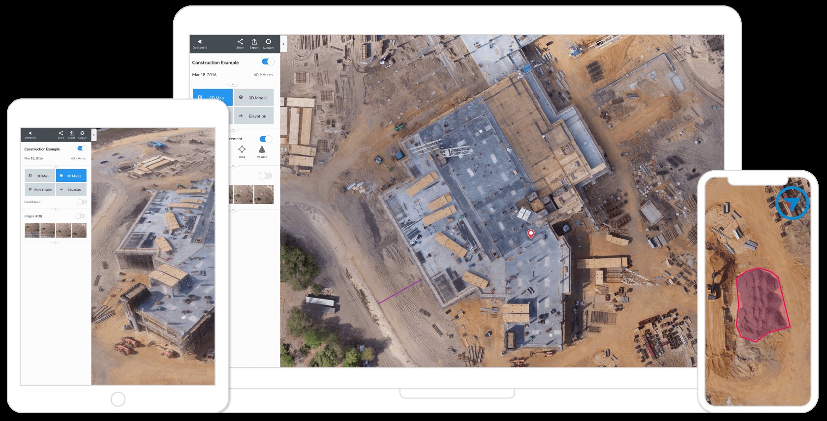
DroneDeploy has been on the market for some time now is often said to be one of the most user-friendly UAV mapping solutions available.
The platform caters to businesses of all sizes, including industries such as agriculture, construction, surveying, solar energy, and mining. And it comes with a mobile app, cloud solution, and a marketplace that integrates with tons of different apps.
You can get started with either a 14-day trial of their Pro solution or use their Explorer plan for free with unlimited flights, 500 photos/map, and 5cm/pixel 2D resolution.
-
Hover — Weather & No-Fly Zones
Hover makes it extremely easy to fly legally and safely.
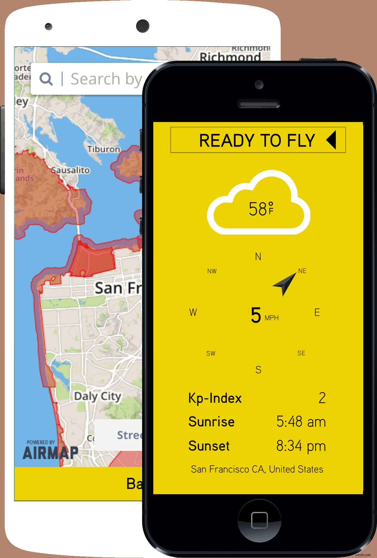
The app shows you no-fly zones in your area, as well as weather conditions such as wind speed, wind direction, temperature, Kp-index, and sunrise/sunset times. You can also log your flights within the app.
It’s one of the simplest apps on the market but also one of the most useful.
-
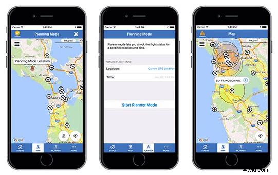
Skyward — Commercial Drone Management
Skyward is one of the most popular management solutions for commercial drone services operators. It helps you plan flight operations, access controlled airspace, track/analyze your flight data, and manage your teams.
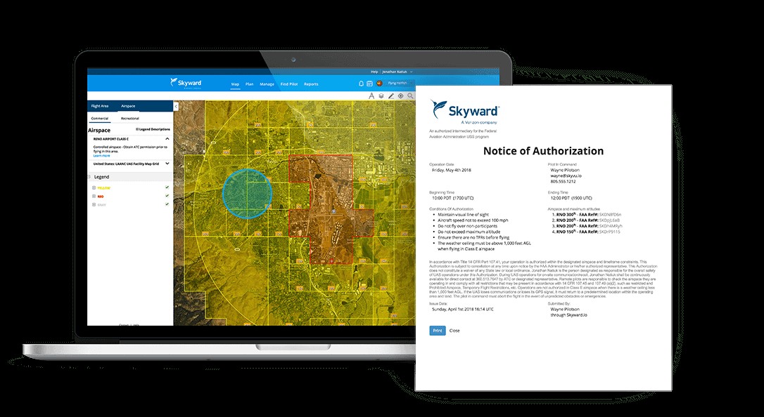
You can draw in flight areas and place hazard markers to let pilots know where to fly and what to avoid. You can create detailed write ups of flight operations with different job details, which is great for both your team and clients. Skyward also allows you to request permission to fly in controlled airspace directly within the app.
When in the field, their mobile app shows you weather conditions, and you can pull up checklists to make sure standard operating procedures are being followed.
Skyward is a robust solution for managing commercial drone operations.
-
NV Drones — Data & Workflow
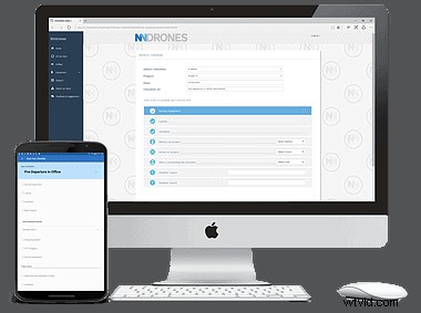
NV Drones is a drone data and workflow platform. It offers automated flight logging, calendar integrations, and custom checklists to keep pilots on task.
NV Drones also gives pilots in-flight telemetry data, such as battery life, range, and GPS data. And it integrates with lots of other platforms and manufacturers.
-
B4UFLY — Legal Flight
B4UFLY is a mobile app created by the Federal Aviation Administration.
It’s available on both iTunes and Google Play, and it offers consumer UAV users the ability to quickly check where they can fly legally and whether their planned route is legal. It also shows interactive maps with different filtering options.
-
Autopilot — Upgraded DJI Flight
Autopilot is like an upgraded version of the DJI Go app. It gives pilots the ability to create automated flight paths, plan and share flight plans, and make detailed use of DJI’s flight modes.
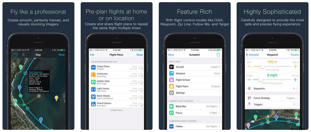
It’s compatible with the Inspire 2, Inspire 1 (Regular, Pro, Raw, XT), Phantom 4 (Professional/v2.0, Standard), Phantom 3 (Professional, Advanced, Standard), Matrice (600, 200, 100), and N3/A3/A2.
-
Ground Control by Measure — Commercial Drone Management
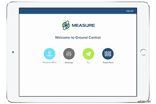
Ground Control provides advanced drone management with flight planning and logging capability.
It allows you to manage tens to thousands of drones, get flight authorization in real time, use assisted manual and automated flight modes, and it automatically uploads data and imagery to the cloud.
-
Tesla Field Recorder — Magnetic Field Detector
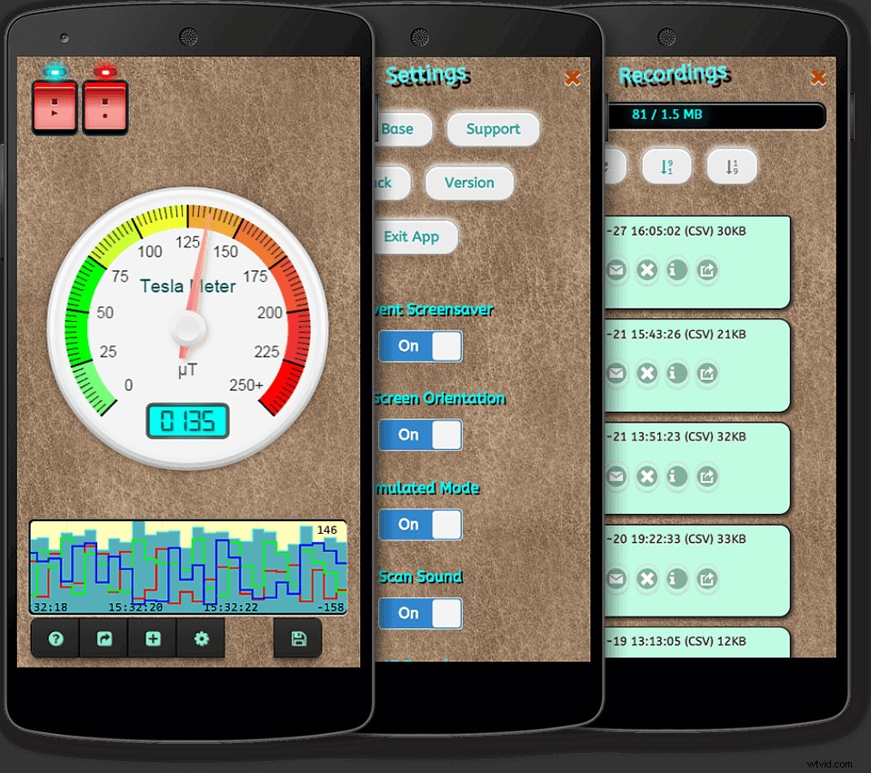
Tesla Field Recorder helps you detect and measure magnetic fields in your area that could disrupt your flight operations.
The app is simple to use and helps you detect metallic objects and magnetic fields, record long-time measurements, and show the strength of these fields in real time to let you know whether or not it’s safe to fly in that area.
-
Verifly — On-Demand Drone Insurance
Verifly is a mobile app that allows you to get on-demand drone insurance wherever you are, starting at $10 an hour.
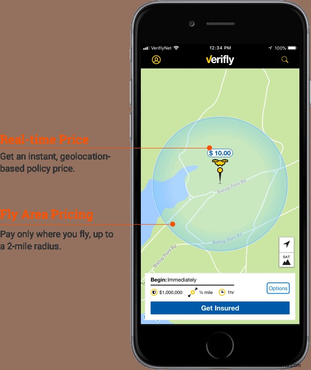
This revolutionary app has made waves in the industry, as drone insurance can be one of the most cumbersome aspects of flying safely and legally.
You simply tell the app where you’re going to fly and it will give you a price for that area. You can then select the options you would like. When you’re finished, you’ll have documentation that proves you were insured for that flight.
Which Of These Is Essential?
For commercial pilots, I believe you cannot live without either Kittyhawk or Skyward. They are excellent management solutions that can do wonders for you business. Verifly is also a great solution to simplify your insurance needs.
For recreational pilots (or just about any pilot), I can’t recommend Hover enough.
With these drone software solutions, your flights will easily hit the next level and beyond.
About The Author
 Mark Sheehan started My Drone Authority to share his knowledge and help people get the most out of this amazing hobby and profession.